 It has been a record breaking week and weekend with temperatures soaring past the 10C degree mark for several days in a row. Temperatures even managed to surpass 20C in some regions including here in Winnipeg, as well there was increased levels of humidity and that is the case today. Although today will be the last day that we experience record warmth and humidity, as a cold front will move through our region dropping temperatures well over 10 degrees. It will feel a lot cooler again for parts of Manitoba tomorrow, but temperatures will manage to stay above zero so frost is not likely.
 The Records we have broken are as follows (Info from Rob's Blog)
List of record highs this past week in Winnipeg
Sun 11 ..... 12.8C (2012) (prev 12.5C 1981)
Mon 12 ..... 9.7C (2012) (prev 7.2C 1922)
Tue 13 ..... 12.2C (1902) (11.7C 2012)Wed 14 .... 11.4C (1981) (10.2C 2012)
Thu 15 ..... 14.4C (2012) (prev 11.1C 1927)
Fri 16 ...... 19.9C (2012) (prev 12.4C 1981)
Sat 17 ...... 19.2C (2012) (prev 12.8C 1938)
Sun 18 ..... 20.9C (2012) (prev 14.4C 1910) *earliest 20C reading on record*
Mon 19 .... 23.7C (2012) (prev 18.9C 1938) *new all time March maximum*
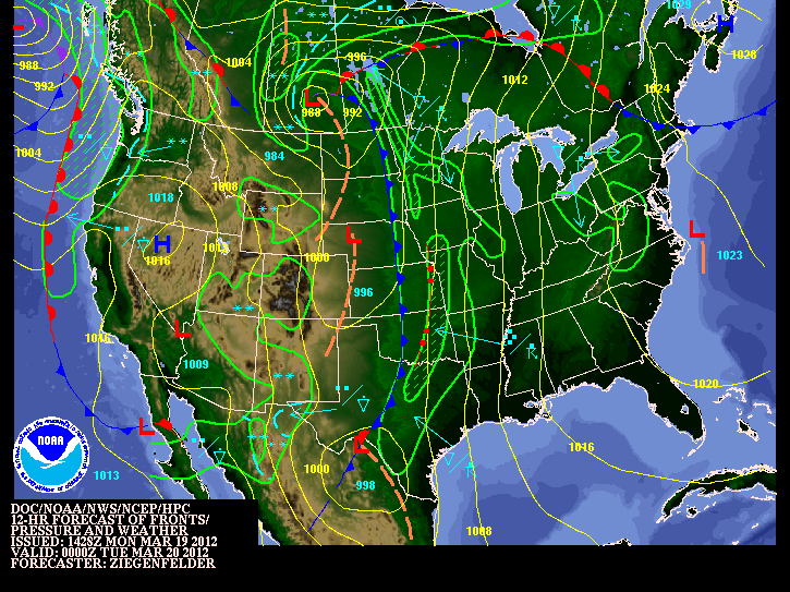

 With a cold front coming through tonight combined with the warm temperatures, and high humidity we have a possibility of seeing the seasons first thunderstorms. It looks like the scattered storms will start to form around 6pm either to the west of Winnipeg, or to the east. Expect them to possibly move through our area bringing total rainfall amounts up to 15mm. The main threats will be heavy rain,hail and possible straight line winds. Some storms may be severe. The storms will push north throughout the evening. As the cold front exits our area expect humidity levels to drop off, temperatures will cool and the winds will shift to the NW. This weather is very unusual for march, although it may give some well needed rains to drought affected areas.
The season's First thunderstorms mark an end to our unseasonably warm weather
 |
| Temperature Trend from Monday March 19th,2012 |

The season's first thunderstorms marched through winnipeg on Monday creating quite a lightshow for so early in the year. They unfortunately marked an end to our summerlike final day of winter over all parts of Southern Manitoba. As Record breaking temperatures well surpassed into the 20C range with summer like humidity. *(According to Rob's Blog)* In Winnipeg the Temperature hit an astounding 23.7C, the warmest march day in the city since records began over 140 years ago (1872). The Temperature reading beats the previous warmest March day of 23.3C set 65 years ago on March 27,1946.It was also Winnipeg's 5th consecutive daily record high, and the 7th in the past 9 days since this historic warm spell began on March 11th.
This warm spell will definitely go into the Record Books. *(Also according to Rob's Blog)*Since Friday, Winnipeg has recorded 4 straight days over 19C. In the previous 140 years of March records, that mark has been reached on only 4 occasions in Winnipeg. In other words, it took only 4 days during this warm spell to match what took 140 years to accomplish. Amazing even for this time of year. This warm spell has also shattered records across the states and even in other parts of Canada, in both extreme and duration. Have a look at this article: Winnipeg gets hit by thunderstorms and Record Breaking heat (Dr.Jeff Masters Blog)
More Records will likely be broken over the next 2 days, as the temperatures are once again forecast to hit the 20C range.


Latest info on thunderstorm development from CWWG
ReplyDeleteSRN MB.. STILL WATCHING FOR LINE OF TSTMS TO DEVELOP OVER SRN MB LATER TODAY INTO THIS EVENING AS COLD FRONT APPROACHES AND TAPS UNSEASONABLY WARM MHUMID AIRMASS OVER SRN MB. LI VALUES RUNING AROUND -2 TO -3 WITH SBCAPES OF 1000-1500 J/KG. EXPECTE STORM STO FIRE UP ALONG ADVANCING COLD FRONT OVER ERN ND AND SPREAD/DEVLOP NWD INTO RRV/SE MB BY EVENING. UNIDEIRECTIONAL FLOW WOULD SUPPORT MAINLY LINEAR STORMS ALONG SQUALL LINE WITH GUSTY WINDS AND 5-15 MM HAIL AS MAIN THREATS.