Friday, April 29, 2022

What??!!! Another Colorado Low?!!! 😔😔😔


Much of southern Manitoba and our region in general has received well over our average monthly rainfall, with the ground . Another Colorado low is poised to impact southern Manitoba, this is significant as the ground is already saturated from previous rainfalls with overland flooding already happening, some areas still are dealing with frozen soil from this winter season. This is not good news for flood outlooks.  A rainfall warning is in effect for Manitoba regions find out more here.., www.weather.gc.ca Read on to find out how much rainfall we will be receiving and what impacts we can expect from this Colorado low


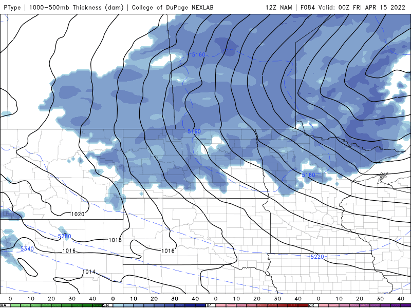
. The rest of Friday: As I write this blog a batch of rain is now moving into southern sections of Manitoba, a large Colorado low pressure system is revving up to bring significant amounts of rain to Manitoba. We will be on the northern edge of this system , as a result the trough extending north of this system will likely create the perfect environment for heavy rainfall in the synoptic form (widespread form). This late afternoon and early evening the rain is expected to blossom and the first batch of precipitation will travel north through the evening. As for temperatures much of the area has already reached our daytime highs, with areas reaching the high single digits to the low teens. Areas in the interlakes more so in the mid single digits. 


Tonight (Above): The low pressure system should be off to the south of us in the states at North Dakota and South Dakota border, the thing is this system will still affect us as the trough line north of it will allow a large swath of rain to sit and move over much of southern Manitoba tonight eventually going as far north as the north end of Lake Winnipeg. Overnight the low will move a bit more to the north resulting in the swath of rain to move over southwestern Manitoba. A general 15 to 25mm of rainfall is likely by the morning hours in the red river valley areas further north and west into the interlakes and portage la prairie can expect a general 5 to 10mm of rainfall. Areas from the international border up to just south of highway can expect 20 to 30mm of rainfall overnight. There’s a risk for thunderstorms in most areas extending as far moth as the interlake regions. Temperatures tonight will drop into the low single digits (2 to 5C) for a large area as cloud cover sits over the area. 


Saturday (Above): This is when the bulk of the rain will occur with this low pressure system, according to the weather models the total rainfall from this system on Saturday could exceed 15mm for a large section of the south. The RDPS is on the conservative side and is considering less than forecast, the NAM is suggesting that by Saturday evening a large area of the province will recieve 20-30mm of rain with as little as 20mm of rain in Brandon and western Manitoba as the rain only happens on Saturday morning, afternoon before pushing east during the evening. Portions of the red river valley and the pembina valley seeing upwards 20 to 40 mm of rain by Saturday evening.  Temperatures on Saturday will rise into the mid to high single digits and low teens (6 to 10C). 


Saturday Night (Above): By this time the system will move off further east resulting in the showers moving south and southeast on the back side of the low, there’s a chance for flurries in the western escarpment of Manitoba lakes into the southwest part of Manitoba generally 2-4cm. A majority of the rainfall accumulations will only be in the 5 to 10mm range, but this will just top the rainfall totals up to levels unfortunately seen last week. I’ll have the rainfall totals posted below after Sunday’s outlook. Temperatures on Saturday night will drop into the low to mid single digits (2 to 6C), the warmest in the red river valley areas. 

Sunday: A chance of flurries or showers are possible during the morning hours in the western red river valley into the interlakes. Drizzle or showers are possible during the afternoon, with only 5-10mm of rain possible during Sunday. Temperatures on Sunday will soar into the low teens in the extreme western end of Manitoba with areas further east seeing high temperatures in the mid to high single digits (3 to 9C).

Sunday Night: By this time the low should have moved east into Ontario, winds will shift to the northwest and there may be a chance for flurries overnight into Monday. Overnight low temperatures will drop well below normal with low temperatures dropping into the low to mid minus single digits (-1C to -5C). 


As for precipitation totals the weatherlogics map used from www.weatherlogics.com is predicting a large swath of the Red River Valley with 50 to 60mm of rain, in some areas and upwards of 35 to 40mm in the southeast and interlakes, up to Arborg, 20 to 35mm from Brandon to Carberry and points north from Brandon and points west 4mm to 20mm. The bulk of the rain will fall in the Pembina valley, interlakes, red River valley, to Kenora and Dryden in NorthWest Ontario as mentioned with 20 to 80mm of rain expected in the southern half of Manitoba. 

This is just an example of what my parents had to deal with last storm when there sump pump seized. 


 I’m saying this with all due respect to be honest I’m very tired of writing about these lows but I really do feel for the farmers and everyone impacted by the flooding. In my life I have never experienced so many storm systems like this in a row, from those clipper systems in the winter months to the crippling Colorado lows of April with this much water and snow. I sympathize with all of those who have been affected by flooding , who have either had lost/damaged property or farmland and for those who have been told to be on the lookout to evacuate. My parents even though I won’t name them, they have also had water damage to there basement with water up to there ankles, after there sump pump seized in the last storm (in st James Winnipeg). Thank Goodness they have insurance.  My thoughts and prayers go to those affected by flooding. 

Regardless I’m going to try to bring you better news, it looks like much of southern Manitoba will gradually begin to see warmer weather next week , with high temperatures only rising to the mid to high single digits for daytime highs next week Monday through Tuesday with lows in the low minus single digits. High Pressure and calm weather will bring temperatures to the low to mid teens (10 to 16C) by Wednesday with overnight lows staying in the mid to high minus single digits or even getting above 10C. 

Friday, April 22, 2022

Warm Weather ushers in Another Colorado Low Pressure System


Our region as a whole has experienced a mixture of  warm and cooler than average temperatures over the past week, as well as a clipper that affected our region yesterday on Wednesday. Unfortunately that has already shifted over and a Colorado low has begun to effect us. This system will bring everything from snow to thunderstorms. Multiple alerts are in effect for this system, please read them here at  https://weather.gc.ca/warnings/index_e.html?prov=mb Read on to Find out what we can expect. Use spotwx.com to access your local regions weather forecast. This blog took me 5 hours to write so please let me know your thoughts. 


Friday (Above): A large swath of rain will develop and fall across the southern half of Manitoba during the day . The beginning stages and this part of the system will give moderate rainfall throughout the day, there’s enough of a chance that a general 5 to 15mm is possible during the afternoon in the red river valley. Before a lull of activity by the early evening with some light rain falling in the interlakes regions.  There’s a chance that even more could fall , based on the HRRR model with upwards of as much as 30mm falling. Temperatures will sit in the low to mid single digits on Friday. With high temperatures across the south between +1 and +3C. 


Friday Night (Above): This is when the system really starts increasing in moisture and the warm front brings in more instability. By this time the low will move into North Dakota. A batch of rain and thunderstorms state side will begin to develop, and move northwards they will impact southern Manitoba and the red river valley.
There’s a chance that some areas in the rain will have lightning and thunderstorms embedded in them. I’m not expecting anything severe however. A general 10 to 15 mm can be expected overnight with the heaviest of the rainfall occurring along and south of the transcanada highway. I’m not seeing any consensus on any snowfall occurring or freezing rain until the early morning hours. Temperatures tonight will drop into the low to mid single digits (1 to 4C) with some areas only sitting around the 0C mark, especially in rural snowcovered areas. 


Saturday (Above RDPS Canadian model): Heading into the day Saturday this is when the weather will begin to turn around, a large area of precipitation will move over much of southern Manitoba. During the morning hours chance of freezing rain will develop in the southwest part of Manitoba. It’s important to mention that this will probably be the beginning of the most impactful weather.  Southwest Manitoba will experience periods of freezing rain with areas in the extreme southwest the most at risk by around lunchtime, what will happen is that this will eventually move northeast through the rest of the afternoon and early evening. 

THUNDERSTORMS AND RAINFALL (RED RIVER VALLEY, SOUTHWEST MB AND SOUTHEAST MB) Theres a good chance, that a period of dry weather will occur in the afternoon, before a resurgence of storms in the afternoon as storms and a large area of rain forms in North Dakota. There’s a decent chance that some of this activity mainly in the red river valley some parts of the southwest part of Manitoba and the southeast will be in the form of thunderstorms, some of them might be strong with the risk of small size hail. These thunderstorms will be elevated however because a moderate amount of instability will be present at middle levels. The NAM is hinting at a general 20 to 30mm with the potential for 35 to 60mm to occur particularly in the red river valley regions, all the way to the border by the pembina valley. The HRRR is hinting at similar amounts. The concern with this is heavy rainfall occurring over the frozen ground will lead to over land flooding, this is why there’s a overland flow flood warning. 

SATURDAY AND SATURDAY NIGHT FREEZING RAIN (SOUTHWESTERN MANITOBA/PARKLANDS and Interlakes)
As for the freezing rain expected, a general 5 to 10+mm of ice, the consensus for this accumulation looks to occur in the Brandon to Manitoba Saskatchewan border towards the American border. This period of freezing rain may start during the morning on Saturday, or start towards the latter half of the day. 


Models are still having a hard time determining the time that it will start, the NAM is showing a large batch of freezing rain sitting over the peace gardens on Saturday moving northeast through the day with patchy freezing rain elsewhere. As the HRRR is showing intermittent freezing rain in the afternoon, in the southwest before a small but intense band moves from the Melita to the Dauphin areas eventually into the interlakes throughout the day but really intensifying by the early evening . Again 5 to 15mm of freezing rain is possible. When it starts could determine the impacts of the system, regardless with the heaviest of the accumulations likely over the international peace gardens region. Power outages are likely if there’s going to be this much in the way of accumulation of ice. Temperatures will sit in the low to mid single digits in the southeast (2 to 6C), areas further west will see high temperature values between 1 and 3C, with the exception of the Riding mountains and the peace Gardens seeing highs around 0C. 


Saturday Night (SNOWFALL AND RAIN CONTINUES ABOVE): This is when things get really interesting, a band of freezing rain will move through southwestern Manitoba into the interlakes during the early evening. A complete switch over to snowfall is likely by the evening and overnight hours, in the southwestern part of Manitoba with a narrow but heavy band of snow occurring from the Melita, Killarney and turtle mountain areas towards the interlakes including the parklands region. A band of mixed precipitation can be expected further east from southern end of lake Manitoba into the Tuelon and the Hecla/Fisher River regions of Lake Winnipeg. A general 15 to 25cm can be expected from the southwestern part of Manitoba into the parklands region, heavy amounts of 30 to 45cm are possible with 50cm in spots in the asseisippi and Swan River area. As for rainfall in the southeastern section of Manitoba and the Red River valley, thunderstorms will be possible in the early evening hours. Some may be strong, with the risk of hail. By the late overnight a general 30 to 60mm will have fallen in the red river regions, the NAM 18z is hinting at 70mm by morning. So it will be interesting to see if we get that much. Saturday Night those warm temperatures we received will only last until shortly after midnight before that cool northwest flow moves in and drops our overnight low temperatures well below average to around the low single digits (0 to 3C). A lot of the warmer air unfortunately will be off to our south. 


Sunday (Above): This is when a majority of the precipitation will shift over, rain will continue in the southeast with a mix of rain and snow occurring over the portage la prairie area down to the pembina valley and the interlakes in the morning. Snow then  will occur in the southeast part of Manitoba, and the interlakes where another 10 to 15cm is likely and locally higher in the pembina valley where 25cm is possible. The wind will take over, winds could gust as high as 70 to 80km/h as the low starts moving east into eastern North Dakota.  Temperatures will take a nosedive as well only reaching the low to mid minus single digits (-1C to -5C), the coldest air in the interlakes regions.  


Sunday Night (Above): This is when the system will start to die down, snow will continue to fall in the southeastern half of the region. A general 2 to 5cm can be expected with light snow occurring overnight. Flurries expected by the morning hours. Blowing snow will die down. Temperatures will drop on Sunday night into the high minus single digits (-5 to -10C).   

Totals for Precipitation using the NAM model, the HRRR is showing similar amounts. It is entirely possible some of these amounts could be underdone or overdone. Again , if you were to encounter heavy snowfall or heavy rainfall in thunderstorms the amounts could be enhanced. 

Rainfall 20 to 70+mm likely by Sunday:


Snowfall 10 to 60cm possible, heaviest in western Manitoba and in the Pembina valley:


Freezing Rain 5 to 15mm possible as shown on this graphic in the southwest and parklands:


The week ahead: Looks like a good return to calmer weather with high pressure but unfortunately temperatures on Monday will struggle to reach highs above zero with highs in the low to mid minus single digits likely, areas with deeper snowpack will see lows in the minus trend (-10 to -18C), areas like the red river valley will see lows in the high minus single digits (-5 to -7C). The rest of the week temperatures in the low minus single digits are likely with some highs above zero, and moderating temps Tuesday night with lows in the minus single digits. The first temperatures in the teens are likely on Wednesday with lows finally above zero. 


Monday, April 11, 2022

Significant snowstorm “Not Seen In Decades” to impact Southern Manitoba

Much of southern Manitoba and our province has had a fairly cool and slightly warm April, that is about to change however. Today I have unfortunate news and I know a lot of you have been following me for a long time, this feels like one of those days that I wish I didn’t have to write a weather update. Unfortunately we all have to deal with what’s ahead, a Colorado low will be moving into our region and with it some extensive impactful weather is expected (this storm and event will be something we all haven’t seen in 3 decades). Find out when, where and what we can expect from this event below. 


Tuesday afternoon the low pressure system will begin to approach from the south, this system will be extremely potent as it taps into the warm air from the south and the cold air just to the north. (Above). As the system moves in on Tuesday morning temperatures will be in the mid to high minus single digits  (-4C to -10C). During the late morning a swath of snow will develop over the northern end of North Dakota and it will drift north into Manitoba bringing with it heavy snowfall and blowing snow. Heavy snowfall rates are expected in the afternoon in the southwest with rain and snow mixing in the southeast. By the afternoon this area of snow will move north into southern sections of Manitoba with most of the snow melting on contact, accumulating snow will probably begin by the late afternoon with amounts of 5-10cm north of the American border to highway number 1 and points north. A few areas may see amounts of 15cm especially along the American border. Temperatures will rise into the low minus single digits in the afternoon with areas in the southwest and parklands  seeing high temperatures from (-1C to -4C). The southeast will likely end up being in the warm sector, bringing those warmer temperatures with highs between 0 and 3C. 


Tuesday Night (Above): This is when the storm will have significant impacts, heavy snow and blowing snow will impact a large portion of southern Manitoba. A swath of snow will set up along the entire southern half of the region. Blizzard conditions will be in place as winds could gust as high as 50 to 60km/h out of the northwest. Model data at the moment is showing that by the early morning hours on Wednesday, accumulations could be as much as 10 to 20cm in the northern sections by the interlakes and near and along the American border. The snow will continue to be heavy throughout the overnight into morning hours. Temperatures on Tuesday night will drop into the low minus single digits in all areas (-2 to -5C). 


Wednesday (Above): By the afternoon significant snowfall will continue in the areas of southwestern Manitoba, and the parklands with the main batch of snow in the south central and southeastern Manitoba moving north into the interlakes region, where they will get more snowfall by the afternoon hours. You can thank this low retrograding as a result , which means it’s going west instead of east. A general 20 to 30cm of snowfall is likely for areas of the interlakes and parklands regions as well. Areas further south will be bearing the brunt of this system with a likelihood of upwards of seeing another 20-30cm especially along the American border or higher elevations. This storm will not be to mess with, as snowfall rates may be as high as 3-6cm an hour. My snowfall totals are an estimate based on model data, and is subject to change. Snow and blowing snow will be an ongoing problem. Temperatures will rise into the low single digits (1 to 3C) in the southeastern portion of Manitoba, under partly cloudy skies. Areas in the southwest will likely see highs in the low minus single digits (-2 to -5C). 


Wednesday Night: This system will continue with a majority of the heavy snowfall moving northwards into the central and northern regions of Manitoba. Meanwhile the snow will wrap back around into southeastern sections of Manitoba. With Another 5-10cm of snow possible in areas of the southwest part of Manitoba. Snow and blowing snow will continue to be an issue, with near zero visibility at times. Another 3-5cm can be expected in the southeast part of Manitoba. Temperatures on Wednesday night can be expected to drop into the low to high minus single digits and low minus teens (-2C to -11C). It will be colder as you move west into the parklands regions. 


Thursday Above: The low pressure system will begin to move east into Ontario, behind it the bands of snow will begin to move east as lighter snow falls with only a general 1-5cm being likely. Snow will begin winding down by the late afternoon and early evening hours, based on the latest GFS model. Temperatures on Thursday will soar into the mid to high minus single digits (-5C to -9C). 


Impacts: Significant snowfall will likely lead to road closures, highways will likely be shut down. Power outages are a likelihood. Once the snow melts flood outlooks will be monitored and water levels will be watched by the province of Manitoba. 

Snowfall Forecast totals: Southwest Manitoba including Brandon, Hamiota, Virden, Melita and Virden. 30 to 40cm. Locally higher over the American border up to 50-60cm
Parklands and Interlakes: Dauphin, Gimli, Gladstone, Russell, Roblin, Neepawa, Eriksdale, Lundar, Stonewall, Selkirk: 20 to 30cm in the parklands to 30 to 35cm in the interlakes. 
South central and southeastern Manitoba: Winnipeg,Beausejour, Ste Anne, Steinbach, Vita, Portage La Prairie, Carman, Elie, Morden, Emerson, Ste Jean Baptist, Winkler: 30 to 35cm, locally 40cm. 
Eastern Manitoba: Lac Du Bonnet, Bisset, Gull Lake, Pointe Du Bois, Victoria Beach, Whitemouth, Whiteshell: 15 to 25cm. Locally higher in heavier bands, 

This storm will rival that of the one in 1997, Winnipeg could also break the record for largest snowfalls ever received in one year. Credit goes to @RobsObs. If we get another 30cm we will be in the top number 1 for most ever in a year, 


After this system moves out. A large area of high pressure will begin to move south into our area bringing with it cooler than average arctic air. Our overnight low temperatures will drop significantly over the next several days after the system moves out with lows going down into the mid minus teens, and daytime high temperatures in the low minus to mid single digits. 

As this happens I’ll be taking a break from blogging until a shift to warmer weather happens. I’m not going to bother blogging about cooler than average weather, as it’s bizzare we have to deal with it this time of year. 


Wednesday, April 6, 2022

Montana Low Pressure System to bring unsettled weather

 Much of southern Manitoba has been blessed with slightly warmer weather than average unfortunately there is a low pressure system from Montana on the way for the day Wednesday into Thursday that will bring us winter weather once again, even though that it’s not going to be a Colorado low it will still bring significant winter weather impacts. Find out when , where and what we can expect weather wise. (This blog will be brief, compared to other posts),

Wednesday and Wednesday Night: During the day a low pressure system east of Manitoba will spread a swath of snow mixed with rainfall. How much snow we get is dependent on how much will melt on contact. A general 10 to 15cm of snow is likely from west to east, mainly in southeastern  portions of Manitoba into the red River Valley. The odd thing about this system is that the precipitation will move from east to west, instead of west to east. Snow should begin clearing the area by Wednesday night into Thursday. The unfortunate thing is that winds will be strong at times with gusts up to 60 or 70km/h at times. Temperatures will stay on the warm side with our daytime highs today getting up into the low plus side of the single digits (1 to 4C).Wednesday night:  Snow will continue into Wednesday night, poor visibility is possible at times. Highway conditions might deteriorate and everyone is advised to stay off the highways given the potential for snow and blowing snow. Temperatures will drop into the low minus single digits with lows anywhere between (-1 to -4C). 


Thursday (Above): Light snow will end by the morning to early afternoon hours, clearing will move in with some broken cloud in the afternoon in the southeast part of Manitoba. Given the suns angle this time of year and the fact that we are now in spring weather mode the chances of having issues with snow melt is much lower. Our daytime high temperatures will soar into the low plus side of the single digits with highs as low as 1C in snow covered sections to as warm as 4C in areas with no snow on the ground. 

Friday: Warm temperatures are likely under high pressure, with our daytime high temperatures soaring into the mid to high single digits (3 to 8C), areas around the lakes may see highs only warming up around 0 to 2C. It seems like winter is having a hard time leaving the province of Manitoba alone, temperature wise. Friday Night: A large area of fog might develop over the red river valley, as temperatures drop into the mid to high minus single digits overnight (-3C to -8C), areas further west in the west man areas can expect lows in the low minus single digits between (0 and -3C)

The weekend: A warmup is possible as a low pressure system moves into our area , bringing with it a chance for rain and maybe thunderstorms* (*that’s a very low possibility). With our temperatures possibly soaring to around 10C with highs certain in the high single digits and slightly above the 10C mark in the southwest. As for areas in the south central and southeast you’ll see high temperatures in the mid to high single digits (5 to 9C). 

Details about next week seem unclear but I don’t see the same signals for a significant winter storm as I did last week on the current model runs.

Friday, April 1, 2022

Warm Weekend, Above Freezing Temperatures

Our region is finally getting back to normal spring weather, thanks to a westerly flow aloft with no polar vortex in sight warmer temperatures are achievable.  The good news about this is that snow will begin to melt more over the coming days. Find out how warm it will get and what kind of weather we can expect for the weekend into the early week. 


Saturday: Saturday morning starts a little chilly with temperatures in the low minus single digits (-1 to -6C), then as we get into the afternoon our daytime high temperatures during the afternoon will soar into the low to mid single digits (1 to 5C). There will be periods of sun and cloud are expected. Snowmelt should be well underway.  Saturday Night: Clear skies are expected across the region, with some cloudy periods during the overnight. 

Sunday: A completely different story comes into play on Sunday, thanks to a low pressure system that will move across the region. Given the fact our current weather models are all over the place, with the NAM only showing a large swath of snow moving through the area, the other models aren’t showing anything significant for the day on Sunday except for some light snow and rain showers in the southwest. I’m gonna go with a small chance at snow in the southwest during the morning and afternoon before it moves east and weakens and there may be upwards of 2-5cm of snow in spotty sections. Most of it will melt on contact however. Temperatures will rise into the low to mid single digits on Sunday with areas of the southwest getting only up to around 2 to 4C areas in the southeast will rise to the 4-6C mark. Sunday Night: The system will weaken by the time it hits the red river valley, will weaken. Some flurries and showers are possible in the evening in the red river valley. 

Sunday Night: A majority of the snow and flurries will move off by the evening hours, precipitation will be scattered in nature. The low pressure system will have moved into Minnesota by the evening, cloudy skies will be in place overnight keeping our temperatures mild. Lows will drop into the low minus single digits in the southwest (0 to -3C), areas in the southeast will drop into the low single digits on the plus side (0 to 3C) in the southeast. 

The week ahead: A majority of the week looks mild, with temperatures warming well into the mid to high single digits. Even close to or surpassing 10C. There also is a chance at more rain or snow on Tuesday.


Featured Post

Major Rainfall first of the season for Southern Manitoba.

Hello folks of southern Manitoba this is another weather update, we have some interesting weather on the way a low pressure system developin...