Friday, February 26, 2021

Quick Bite back of winter on the way !

 Southern Manitoba will be under the influence of a couple of areas of low pressure over the first half of the weekend, which will contribute to some unsettled weather. The mild weather we are currently experiencing will not last into Monday. Read on to find out what we’ll see weather wise and how cold it will get . 


Friday: Southern Manitoba will likely experience a cloudy day with exceptions of extreme southern sections of the province right along the border in southwestern Manitoba. There will be a narrow swath of rain and snow which will move across southern sections of the province depending on the temperatures there is a chance for a brief period of freezing rain. However there appears to be a higher chance of rain mixed with snow. Areas closer to the border may experience just rainfall this is dependent on temperatures which we will evaluate below.In general expect a narrow swath of 3 to 5cm from Brandon east to Winnipeg with lesser amounts North and south of that. Areas from the Southeast corner of Manitoba into the Winnipeg region may see some periods of rain mixed in with the snow.  Temperatures throughout the afternoon will peak shortly before noon and then gradually drop throughout the afternoon into the evening. So temperatures in the early part of the day (10am-3pm)in the extreme south eastern portion of Manitoba from Winnipeg south will see highs in the low single digits (0 to 4C). Areas for the rest of southern Manitoba will be in the low minus single digits (0 to -5C). Winnipeg: Periods of snow mixed with rain, high 2C temperature falling to -2C in the late afternoon. Snowfall amount: 5cm. Brandon: Periods of snow, amount 2-4cm. High -1C temperature falling to -3C in the afternoon. 

Friday Night: An area of high pressure will build south from the Northern Prairies as a result clear skies with small patches of cloud cover will filter into regions of Manitoba. There may be a chance for some snow in sections of southwestern Manitoba, before clearing by morning.  Overnight lows will once again drop into the mid minus teens (-10 to -15C), with the exception of the parklands and parts of the inter lakes seeing lows in the low minus twenties (-20 to -23C). Winnipeg: Partly cloudy. Low -12C. Brandon: partly cloudy, low -12C. 

Saturday: An area of high-pressure will continue to build south and will also sit over the prairie provinces, as a result temperatures will be a little bit cooler than they have been. Mainly cloudy skies are expected in southwest Manitoba with sunny skies expected in the southeastern section of Manitoba. Temperatures for the day on Saturday will only sit in the low to mid minus teens (-12 to -16C) for all areas except for extreme southeastern Manitoba from Ste Anne and Steinbach which will see highs in the high minus single digits (-5 to -10C. I guess the sun does help temperatures rise a little bit . Winnipeg: Cloudy. High -14C. Brandon: Cloudy, high -14C. 

Saturday Night: Not much in the way weather will be occurring on Saturday night mainly clear skies are expected as that area of low pressure moves off into North Dakota. Overnight low temperatures for the majority of the region will take a nosedive into the mid minus teens (-15 to -19C). A small section on Lake Manitoba will see lows below -20C. Winnipeg: Clear, low -17C. Brandon: Clear low -16C. 

On Sunday; an area of low pressure will be situated in northern Saskatchewan as it drifts south, ahead of this warm air will filter into southern sections of the region. Cloudy skies will also move in with an area of snow moving through from southwestern Manitoba into the red river valley and western parts of southeastern Manitoba. There is a good chance at picking up 2 to 5cm of snow. Temperatures on Sunday afternoon will be in the mid to high minus single digits (-5 to -10C). Winnipeg: Periods of snow beginning in the afternoon , amount 2 to 4cm. High -7C. Brandon: Periods of snow beginning late in the morning. High -5C. 

Sunday nights: A pretty rapid temperature drop will occur as a cold front swings south bringing a arctic air mass with it. Along with this clear skies will aid and temperatures dropping into the mid minus teens to low minus teens with the potential for very cold overnight lows in the -20s in areas of the parklands and the inter lakes. Luckily it will not be extreme cold that we have experienced over the past three weeks. Winnipeg: Clear. Low -19C. Brandon: Partly cloudy low -19C. 

The rest Will be updated at 2pm. Model data is still iffy after Sunday. 


Thursday, February 25, 2021

Welcome back warmer weather and a little sneak peek at what’s ahead for the blog!

Good morning folks. Just a recap over the past couple of weeks, Manitoba has transitioned  from a colder than normal weather pattern into a more seasonal pattern for this time year. Our temperatures transition from the -40s to the positive single digits and more seasonal values for  this time of year. I know I have not posted for a while however it’s a result of a busy schedule, should be back to regular posting later on today with a post for the weekend ready on Thursday evening. I’ll have an outlook for the weekend into next week starting next week my post will resume back to their normal schedule. Things are going to be little bit more structured I’ll have posts on Monday’s Wednesday’s and Fridays. They’ll be posted on here before midnight of those dates as I for some reason cannot do scheduled posts. 

Saturday, February 20, 2021

Warm weather for the weekend

 This,, blog post will be short and sweet. This weekend I am expecting us to transition into some of the warmest days of the winter. All courtesy of a low pressure system moving into southern portions of Manitoba ,with a warm front moving in on Monday. This will push temperatures into the mid minus single digits and some areas in the southwest may see temperatures a few degrees above zero. Wonderful weather for much of southern Manitoba on the weekend, .  

Not much in the way of precipitation is expected, I’m expecting sunny skies over the weekend with little in the way of cloud cover. Overnight lows on the weekend will sit in the low minus teens, some sections in the inter lakes may reach the high minus teens. This warmer than average trend will increase as we head into the week. More details coming on Monday!!

Wednesday, February 17, 2021

Extreme cold ends. Colder than average weather continues.

Our colder than normal weather pattern continues as we head into the second half of the week,  the good news however is that we have finished the extreme cold that we experienced over the past 2 weeks. Find out when the transition into warmer weather will occur and how long are cooler than average temperatures will continue for. 


Wednesday: Southern Manitoba will be on the western edge of a high-pressure system in the prairie provinces. Along with a weakening trough.  Partly to mainly cloudy skies are expected for Southwestern Manitoba in the afternoon and evening hours with a chance for light snow , sunny skies can be expected throughout the day along with calm winds in the afternoon. Temperatures for the afternoon will be in the Low to mid minus teens (-12 to -16C). Windchills however will be in the -20°C to -30C range. Winnipeg: Partly cloudy. High -13C. Brandon: Partly cloudy . High -14C. 

Wednesday night: Partly cloudy skies are expected, there will be a chance for some light snow as a trough of low pressure moves through. Lows on wednesday night will be in the minus 20’s (-20 to -27C) in southwestern Manitoba with some sections in the parklands and interlakes. Areas of southeastern Manitoba will see lows in the high minus teens (-15 to -20C). Winnipeg: Cloudy 60% chance of flurries, low -17C. Brandon: Flurries ending in the early evening then cloudy, low -26C. 

Thursday: Transition into warmer weather!!! Thursday will be the first of many warmer days to come for the second half of the week into next week. A northwesterly to westerly flow aloft along with some sun in southwestern Manitoba and clouds in southeastern sections of the province will aid in temperatures rising into the low to mid minus double digits (-10 to -16C), with the warmest air in southeastern Manitoba. Winnipeg: Partly Cloudy high -16C. Brandon: Partly Cloudy high -18C. 

Thursday Night: During the night the area of high-pressure that was off to the west will be moving into Northwestern Ontario, mostly clear skies are expected throughout the overnight. Winds however will be light which will keep windchills a tad warmer. Temperatures will be in the mid to high minus teens (-15 to -19C) overnight in southeast Manitoba, with temperatures between (-18 and -25C) in the southwest part of Manitoba. Warmer temps in the Dauphin areas and extreme southwest Manitoba (-15 to -20C). Windchills in the high minus teens in southeast Manitoba, (-15 to -20C). As well as windchills in the low to mid minus 20’s in the rest of the southern half of Manitoba. Winnipeg: Clear, low -18°C.Windchill -21C. Brandon: Clear, low -20C. Windchill -21C. 

Friday: An area of high pressure will move into Ontario bringing in a southerly flow behind it. This will be one of the more significant days of warmth that we have seen in a very long time, our daytime high temperatures for the first time in over two weeks! Temperatures will soar into the low minus double digits (-10 to -12C), in the inter lakes and the parklands. High minus single digits (-5 to -10C) in much of the southern half along and south of the yellow head and highway number 1. Windchils for the majority of the southern half of the province will still be in the minus teens (-15 to -20C)  temperatures however they will not exceed the values we have experienced over the past few weeks. Mainly cloudy skies are forecast in the southeast with sunny skies for the remainder of the region. Winnipeg: Mainly Cloudy, high -9C. Brandon: Sunny. High -9C. 

Friday night: A week low pressure system looks to impact parts of southern Manitoba with a potential for a quick but heavy band of snow, accumulations should not be too much. Overnight lows should be in the high minus single digits in the southwest and the low to mid minus teens in the south east. Cloudy skies are expected for most. Winnipeg: Cloudy, 60% chance of snow early in the morning. Low -14C. Brandon: Cloudy, 60% chance of snow overnight. Low -10C. 

Into the weekend this warmer than normal temperature pattern looks to continue with the potential for daytime highs to finally reach the low to mid minus single digits into the low teens and the potential for a few degrees near zero. 

Thursday, February 11, 2021

Extreme cold weather continues, warmer weather on the way soon.

Southern Manitoba including the rest of the province has been under a extreme cold air mass over the past week, this is due to a arctic high-pressure system and polar vortex sitting over the prairie provinces. Unfortunately this pattern looks to continue for the second half of the week into the weekend, the only relief may be a small trough of low pressure coming through during Friday. However there is some good news , read on to find out when the cold will end. There is also a bit of a surprise for you, in the forecast section). 🙀🙀🙀. 


An extremely colder than normal airmass continues to sit over the province. Even though these temperatures are in Fahrenheit they are still in the minus 30s on Friday. It just goes to show how large an areas this airmass covers.  


Tonight (Wednesday Night): A area of high-pressure will sit over the prairie provinces mainly clear skies can be expected. The dominant factor will be extremely cold overnight low temperatures. Overnight lows will drop into the mid -30s to low -30s (-35 to -38C) with the coldest temperatures occurring in south western Manitoba and the Interlakes region. Windchills will be the worst in south western Manitoba in the -40 to -47C range whereasareas in south east Manitoba will be in the -37 to -40C range. Winnipeg: Clear low temperature -32C windchill -42°C. Brandon: Clear within partly cloudy low -34°C windchill -46°C.


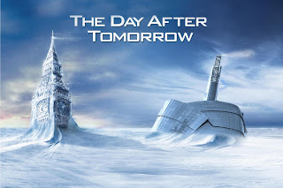
Thursday (will be the coldest day of the week, hence my day after tomorrow Winnipeg version photo above, 😂😂 don’t worry it won’t actually get like that I promise you. ).  : During Thursday there appears like there may be some cloudy skies for the day with some off and on flurries, only areas that will see sunny skies are portions of Southeastern Manitoba particularly the Interlakes as well as the red river valley. There is a small chance for flurries during the afternoon hours. Southern Manitoba can expect temperatures to be in the mid to high -20s in the afternoon (-20 to -29C) factoring in the windchill itll be in the low to high -30s windchill (-31C to -39C). Winnipeg: Mostly cloudy 30% chance of flurries. High -24°C, windchill -32°C. Brandon: Partly cloudy: Hi -26°C, windchill -37°C. 

Thursday night: A cold arctic air mass will continue to affect the region and I would not be surprised to see temperatures drop well into the -40s overnight. Clear skies are forecasted which will allow for extremely cold conditions with frostbite it possible in minutes. Temperatures Will drop into the mid -30s to high -30s (-35 to -40C in the red river valley) overnight, elsewhere only expect low -30s (-30 to -35C). Winnipeg: Clear, low -33°C windchill -42C. Brandon: Clear. Low temperature -38°C, windchill -47°C. 

Friday: Shouldn’t be too bad of a day,  A trough of low pressure will be moving through the region allowing for more cloud cover to develop then on Thursday. Cloudy skies with occasional flurries are expected throughout the afternoon some areas may receive a trace to 2cm. Temperatures will reach day time highs in the mid to high -20s ( -25 to -30C), windchill values will be in the high minus 20s in the SW and low -30s in the southeast part of Manitoba. Winnipeg: Mostly cloudy, 30% chance of flurries. high -24C. windchill -30C.  Brandon: Mostly cloudy, high -26°C windchill -30°C.

Friday Night: The bulk of the cold air looks to impact a majority of southern Saskatchewan and south western Manitoba, whereas areas a bit further east Will not be in for as the same extreme cold compared to the past couple of nights. The reason behind this is that there will be a small disturbance moving across the south eastern portion of the province bringing areas of thicker cloud cover which will inhibit temperatures from dropping too much. Temperatures in Southeastern Manitoba will drop into the mid to high -20s, from -23°C in extreme southeastern portions of the province to -28°C as you get towards the Winnipeg region. Areas west of that will be seeing temperatures in the high -20s to high minus 30s. -28 to -37°C. Windchill values will be in the mid -20s to the mid -30s. Expect -25°C in the southeast to -35C, as you head towards the Winnipeg region temperatures will drop drastically. Windchill  values will range from the mid -30s to high minus 40s. Expect windchill values from -35°C to -47°C in the south western portion of Manitoba. 

The weekend: This abnormally cold weather pattern will continue into the weekend with our daytime high temperatures still in the -20s with windchill‘s in the -30s , and overnight lows in in the -30s with windchill‘s in the -40s. It’s colder than normal weather pattern looks to continue into next week with a moderating temperature pattern as we get towards the end of the week.

Monday, February 8, 2021

New Blog Announcement

 Starting over the coming months I will be finding ways to create forecasts for northern Manitoba, at the moment I’m only creating forecasts for southern Manitoba as I don’t have the time and resources to do northern regions at the moment. Radar data and Sattelite Data is also sparse up North making it even harder to forecast. My plan is as we head towards spring likely at the beginning or the end of March and April I will be beginning to look at the northern regions. If anyone has suggestions on regions that I could provide details for in the north please leave them  in the comments section. I hope you guys continue to enjoy my blog starting this week on Friday I will be getting back to regular posts during Fridays Mondays and Wednesdays. I should have a blog posted within the next 1 to 2 hours.

God Bless!! -Mike


Monday, February 1, 2021

Warmer than average winter weather continues, winter. Extreme cold wallop to come ???

Manitoba will continue to experience a warmer than normal temperature pattern over the coming days. Multiple low pressure systems coming in from Alberta and Saskatchewan look to traverse across the prairie provinces into the weekend. As they sit over the region it’ll bring a strong southerly flow with mild temperatures and strong wind gusts. A pattern change looks to come, but when ?? Read on to find out more.


Tuesday: Will be one of those cloudy days an area of low pressure will be sitting over the central portion of the province Manitoba. Chance at some off and on flurries throughout the afternoon and early evening otherwise mostly cloudy skies can be expected. An exception will be in areas in northern Manitoba where a large area of snow will be impacting portions north of Thompson including Thompson north into Churchill. Unfortunately much of Manitoba will be missing out on the double digit temperatures expected in southern Saskatchewan on the plus side, however we will likely see temperatures in the mid to high minus single digits in the afternoon. A few areas in SW Manitoba may see values a couple degrees above freezing. Generally (2 to -7C) can be expected for daytime highs. Except for extreme northern portions of the province will get temperatures in the mid to high minus double digits North of Thompson. Winnipeg: Cloudy, 30% chance of flurries in the afternoon. High -4°C. Brandon: cloudy 30% chance of flurries in the afternoon high -1°C. Dauphin: Cloudy, 30% chance of flurries in the afternoon high +1°C. Thompson: Hi -6°C. Cloudy, snow beginning in the morning. Amount 5 cm.

Tuesday night: Cloudy skies are expected for the entire province of Manitoba overnight, the only exception will be that a large area of heavy snowfall which could bring up to 15cm of snow, will be occurring in northern  portions of Manitoba. Snow will only occur from the Northern border into areas just south of Thompson not including The Pas. Areas of southern Manitoba will not experience any snowfall overnight. Of concern is a cold front moving through the overnight which may interact with warmer air above the surface, creating a risk for freezing rain overnight in central portions of the province just south of Thompson into southern sections particularly just north of Winnipeg. Temperatures throughout the night will drop into the mid to high minus single digits for a majority of Manitoba, (-5 to -10C). Windchills in the inter lakes ,red river valley , central Manitoba will be between -10 to -15C. A section of only high minus single digits windchill will occur from the parklands, southwestern Manitoba just south of Thompson. Areas along highway 6 into Thompson will see overnight lows in the mid to high minus double digits with windchills in the (-20 to -35C) range. Winnipeg: Cloudy: 30% chance of flurries, overnight with a risk of freezing rain. Low -5C. Windchill -10C. Brandon: Cloudy, low -10 Dauphin: Cloudy. Low -4C. Thompson: Cloudy, snow at times heavy,  Low -10C. Windchill -20C overnight. 

Wednesday: A low pressure system will be moving through the entire portion of Manitoba during the day on Wednesday.  There is some model disagreements looking between the NAM and the RDPS, RDPS looks to be less potent when it comes the snow in northern sections of Manitoba during the morning. Regardless I would still expect a large area of snow mixed with rain and freezing rain in the afternoon hours from the inter lakes into SW regions. A small band of freezing rain is possible in south western Manitoba into the red river valley by evening hours. Temperatures for a majority of the region from just south of Thompson all the way to the American border not surprisingly will see highs again in the mid minus single digits (-3 to -7C). Areas along the western border of Manitoba into northern Manitoba can expect to see windchills of (-10 to -15C), with (-15 to -25C) windchills in northern Manitoba.  And in extreme northern regions (-25 to -35C). Winnipeg: Cloudy, 60% chance of flurries in the morning then snow beginning in the afternoon, risk of freezing rain in the afternoon and early evening. High -3C temperatures falling to -5C late in the afternoon. Brandon: Cloudy, snow mixed with freezing rain beginning in the early afternoon. High -3C, temperature falling to -6C late in the afternoon. Dauphin: Cloudy, Periods of snow beginning late in the afternoon. High:-4C. Temperature falling to -6C in the early evening. Thompson: Cloudy, periods of snow high -12°C, windchill -19°C. 

Wednesday night: Any residual snow or freezing rain is expected to taper off gradually through the evening. The area of low pressure will depart into northwest Ontario and Minnesota leaving a very cold arctic air mass behind the cold front. This is what will allow a transition into colder than normal temperatures. Clear skies will also contribute to this very cold arctic air mass. Areas of northern Manitoba will be the first to experience the cold it is expected that that will filter south through the night. Temperatures by region, Areas of Southeastern Manitoba will escape the extreme cold with only lows from -5 to -10C (windchills -10 to -14C) for the Red River Valley Interlakes Central Manitoba western Manitoba and areas up to the highway six Corredor heading towards Thompson . will see -10 to -20C overnight lows. The -20 to -30°C windchill‘s will be occurring over the Lake’s Southwestern Manitoba into northern portion of the province. The more -10 to -20°C windchills are forecast in the Red River Valley, Interlakes including the parklands and eastern Manitoba. Areas of Extreme northern Manitoba will be experiencing the worst of the cold -20 to -35C (windchills -30 to -45C). Winnipeg: Clear, low -10C. Windchill: -19C. Brandon: Clear, low -13C. Windchill -24C. Dauphin: Clear. Low -13C. Windchill -20C. Thompson: Clear low -19C, windchill-28C. 


The second half of the week: Looks like the high pressure system and arctic air mass will continue to filter into Manitoba, this will contribute to daytime highs well below normal in the mid to high minus teens in the south with windchills in the minus 20s. Mid minus 20s in the north with windchills below -30C.  Overnight Lows will be in the high -20s in the north with windchill‘s well into the -30s and -40s. Overnight lows will be in the high minus teens to  -20s in the southern half of the province with windchill‘s in the low -30s. The bad news is that the cold looks to increase as we head towards the weekend what this means is that we will start seeing temperatures well below average. There is a good indication that we will see temperatures in the -20s or -30s with windchill’s in the -30s to -50s. More details arriving on the Friday afternoon weather blog.


Featured Post

Winter Storm Set To Impact Southern Manitoba during the day on Sunday

 Hey everyone it's Mike here writing a brief update on a significant winter storm that is likely to impact will be impacting southern Ma...