I apologize for not having any blog posts on the hot weather over the last few days. I took some time off for the long weekend, it was enjoyable as I was able to spend time with family and friends. Anyways Southern sections of Manitoba are likely to expect another day or 2 of hot weather, there’s also a chance for some showers and thunderstorms find out when and where in this blog weather update.
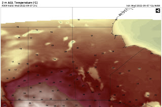
Temperatures above for the day on Wednesday showing the reality of the heat over western Canada. Some areas seeing highs in the low 30’s.
Wednesday: Will end up being one of the nicest days of the week , high pressure will be off to our east in the northeastern USA which will contribute to a warmer than average airmass over our area. Temperatures during the day will soar into the mid to high 20’s with the hottest of the weather in southwestern Manitoba into the red river valley.
Wednesday Night: A warm front and low pressure system will move through our area overnight the dynamics however are not as strong for severe weather than previously thought. There’s high amounts of instability with Thunderstorm energy in the 1,000 to 2,000 range but there will be sufficient capping (prevents storm formation as a layer of warm air overtakes areas where cold air is needed for storms) and limited amounts of moisture. If storms do form only isolated non severe thunderstorms are possible, with a very slight chance of a isolated severe storm. Best threat is in the red river valley late night early morning. Temperatures will sit in the high teens to low 20’s on Wednesday night.
Thursday: The low pressure system I mentioned will move out of the region bringing with it a chance for some showers or weak thunderstorms in the morning hours. Mainly cloudy skies are possible for the rest of the day with most of the moisture moving off to the east. Temperatures will probably reach the high teens to low 20’s for, the coldest of the air is expected to be in the west with warmer highs in the mid 20’s in extreme southeast Manitoba.
Thursday night: Calmer weather is likely with a chance of clearing in some areas of the west. The cloud cover, fortunately will sit over the eastern half of Manitoba. With us being on the right side of high pressure it will give us a northerly flow aloft. Our temperatures will drop possibly into the mid single digits (3 to 5C) for the first time this fall especially in western Manitoba, sections of the red river valley and the interlakes. Winnipeg and southeastern Manitoba may see lows in the low teens.
Friday: Will end up being sunny but a cooler than average day, our highs will only reach the mid to high teens. A persistent northerly flow will be part of the issue. Friday night temperatures will drop into the mid to high single digits across the south, these are more like October overnight lows. Frost is also a risk , once again I hate that darn Jack Frost. 😆😆.
The Weekend: Warmer weather arrives , on Saturday temperatures in the high teens to low 20’s is possible overnight lows in the high single digits in the west and east and low teens in the red river valley. Most of the warmer weather coming on Sunday, I’m looking at a return to temperatures in the high 20’s on Sunday and into the week where high temperatures in the low 30’s are possible with lows in the mid teens to low 20’s. Humidity may increase as well so we will have to watch for showers, thunderstorms. However it could end up being a dry heat with current data showing low dew points. That could change especially near the end of the week as a trough of low pressure builds in. That’s another reason why I don’t trust long range forecasts , data is inconsistent.


No comments:
Post a Comment
Thank's for commenting on the blog, I appreciate it...