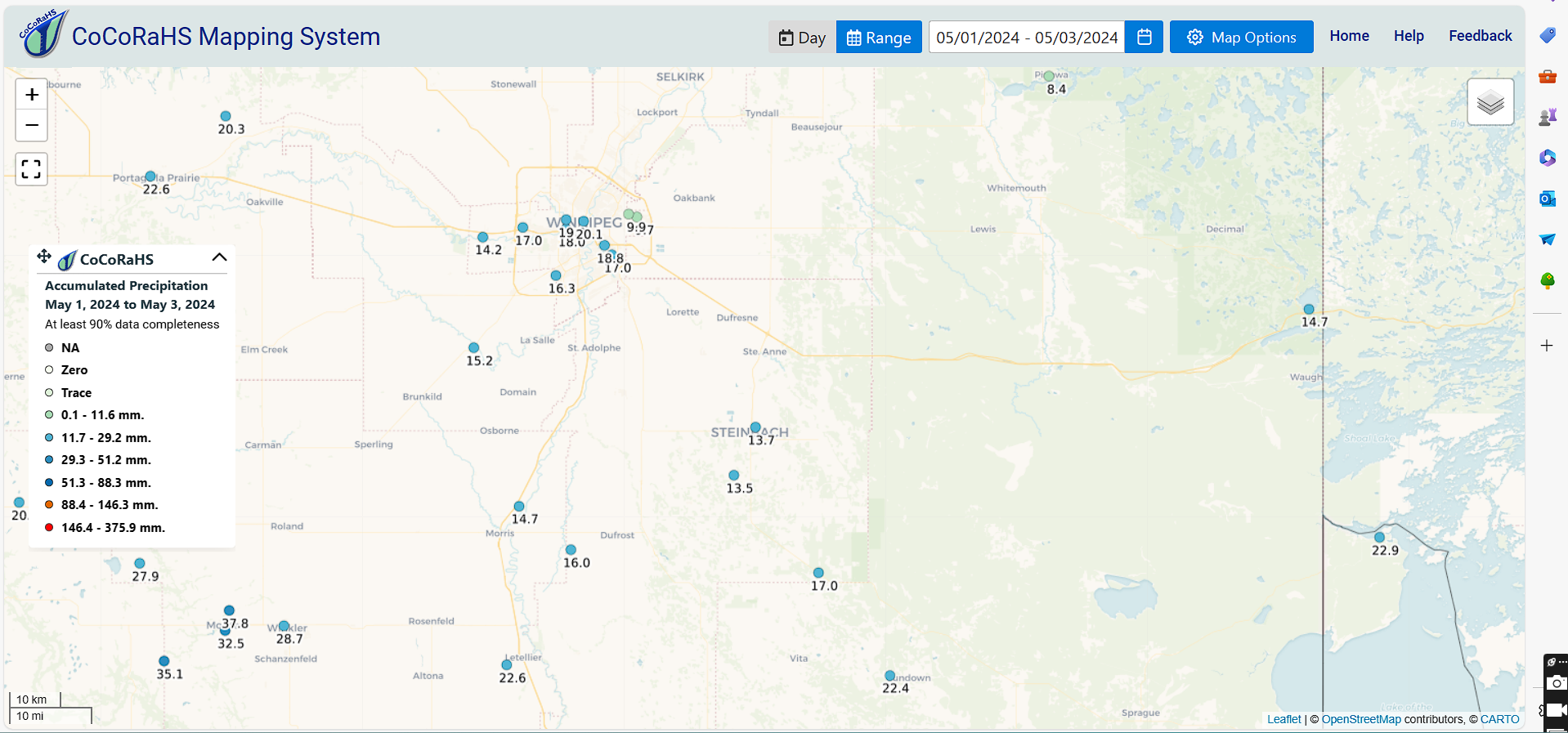
Hello folks of southern Manitoba and those weather watchers in the southern part of the province we have an update on the weather for the weekend into early next week we'll see if we can add some information about the weather into the 2nd half of the week. On the heels of a low pressure system which impacted majority of southern Manitoba over the last couple of days is now moving into northwestern Ontario behind it a large area of high pressure will develop which will bring us slightly cooler temperatures to start the weekend however as we get into start the week it appears that we could have a return to warmer than normal conditions. Bottom line of beautiful weekend is more than likely to happen for us. In regards to the amount of rainfall that received areas west of Winnipeg received between 20 and thirty millimeters rain areas of southeastern Manitoba also picked up about 20 to twenty five millimeters of rain areas further north including the Interlakes only picked up about 10 to fifteen millimeters of rain and areas of the southwest also picked up similar amounts. I have attached three photos below with information on where the heaviest rainfall occurred from the CO CRAHS maps.


Saturday: High pressure looks to impact the majority of our region during the weekend specifically Saturday and Sunday could be some of the nicest days we've had in a long time, sunny skies are likely with high temperatures for majority of our region reaching the low teens and some areas may get close to the fifteen degrees celsius mark.
Saturday Night: Southern sections in Manitoba will be in a much cooler air mass on Saturday night as well mostly clear skies are likely however there is a possibility of fog patches developing in the Red River valley the good news is that this will not persist. There is also a low risk of frost for areas of The Western escarpment and areas around the Manitoba Lakes. Temperatures for a majority of the region will drop into the low to mid single digits.
Sunday: This will be one of the warmer days of the weekend and I'm actually kind of surprised with the latest model data suggesting high temperatures in the high teens for a majority of the our region especially if you're gonna be closer to the American border some areas could receive or at least get up to about twenty degrees Celsius this is something we have not seen in a couple weeks. The warmest of the weather is also likely to continue as we head into the week details on that below.
Sunday Night: Overnight low temperatures will likely stay warmer again during the overnight. Sunday instead of seeing our little values drop closer to zero our low values will drop closer to the 10 degrees Celsius mark so that's a switch up from what we are forecast to see on Saturday night.
The week ahead: it looks like much of southern Manitoba will be in a warmer temperature pattern however a little pressure system is expected to impact southern Manitoba during the day on Tuesday through Thursday, There is a possibility however that this system decides to move W further into Saskatchewan and Alberta there is a possibility that this may change depending on where the position sets up but a majority of the rain is likely to impact the Western prairies.We're still figuring out the details about this system. If the forecast changes and we get rain for our region during the week it'll be welcome news for our farmers.


No comments:
Post a Comment
Thank's for commenting on the blog, I appreciate it...