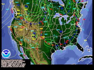
Colder than normal weather conditions will be expected this week over Southern Manitoba as another upper level disturbance crosses over Southern Manitoba midweek, bringing behind it cooler air. This will mark the start of another pattern change that could stay in place for a few weeks.
 | |
| A powerful low pressure system will cross Southern Manitoba through the Night Tuesday and Through Wednesday, bringing behind it cooler weather for the second half of the week. The Welcome relief banner is published in this picture as the cool air will bring releif to those that experienced unrelenting heat in the upper states. Especially in Chicago. This photo is from The Weather Channel. |
To start off the night tonight we will experience clear or clearing skies in Southern Manitoba, along with light winds either out of the north or the northwest allowing for our temperatures to drop past the 10 degree mark. So we will likely see temperatures in and around the 7 to 10C mark overnight, however that will allow for some patchy fog to develop considering how warm the ground is and how cool the air will be. Usually in this situation moisture usually develops especially near the ground. Any leftover fog should clear out by sunrise leaving behind sunny skies and temperatures rising into the low to mid 20's (from about 22C to 26C), before more cloudcover rolls in ahead of the next system in the evening as the high pressure we are under departs. Temperatures in general for this period should be in the high 20's, and in Winnipeg the normal high temperature should be 25C/ low temperature 12C.
 |
| Another cold front will move through MB Wed Morning |
The pattern change looks like will be in store for us by midweek. It looks like a major cold front will swing through Southern Manitoba through Tuesday Night and into the day Wednesday. The timing on this front may change, so I will update as needed. With the approach of this front expect showers and thunderstorms to generate over the Parkland’s Tuesday Evening and spread south-eastwards as the night progresses. The showers and storms will eventually travel into the Red River Valley, during the morning hours likely in a line and they would possibly exit the province by afternoon. The thunderstorms would likely become non severe with general threats below the severe threshold. Meaning lightning, rainfall in excess of 20 mm or less, small hail, and weak wind gusts. The remnants of this cold front will bring pop up showers and thunderstorms being fairly weak and disorganized in general to most parts of southern Manitoba. Temperatures would likely be in the low twenties throughout the day Wednesday, with cooler weather expected by the end of the day as a cool Northwest wind takes shape behind the front.
Throughout the second half of the week we will likely see some cooler days with temperatures in the high teens to low twenties, as the low moves eastward. Looking ahead to the next couple of weeks, it appears difficult to predict. (I have found the following using the jet stream forecast model). With a ridge out west and a blocking pattern out East will be stuck in-between the two, meaning the likely trend will be seasonal weather until that blocking pattern moves on. After that, the ridge could either keep moving East or flatten out bringing us the same seasonal weather or another warm period. I will keep an eye on the situation and let you know how it plays out.


No comments:
Post a Comment
Thank's for commenting on the blog, I appreciate it...